Hide Comments
If you’re in Salt Lake City, Utah and looking for fairly easy, short hikes with views, check out Millcreek Canyon. It became my favorite canyon to take visiting friends and family when I first moved to Utah. Just 17 minutes from downtown Salt Lake and bonus–it’s dog friendly!
Check out my hiking guide to Mt. Wire–a casual day hike right behind the University of Utah.
There are a few hikes I’ve done repeatedly that have become my go-to spots. These top three Millcreek Canyon hikes (in order from shortest to longest) are:
NOTE: There is a $5 fee per car to use this canyon and you will be asked to pay when leaving the canyon at the entrance booth. This canyon is managed by the US Forest Service and owned by Salt Lake County Parks.
I love this hike because the views are incredible, I get a decent workout, and it’s convenient to get to as one of the first hikes in the canyon.
The trailhead is about a mile up the road from the entrance booth, on the left side of the road. It used to be just a dirt parking lot but in the last year, they’ve completely redone the parking lot.
You’ll see a nice, big paved parking lot with two pit toilets and a big trail sign. There are a few trails that start from this parking lot, just follow the signs for Rattlesnake Gulch.
The first half of this hike will get your heart pumping. You’ll ascend about 700 feet through a shaded, forest trail and then turn left when you reach a sign at the junction for Pipeline Trail.
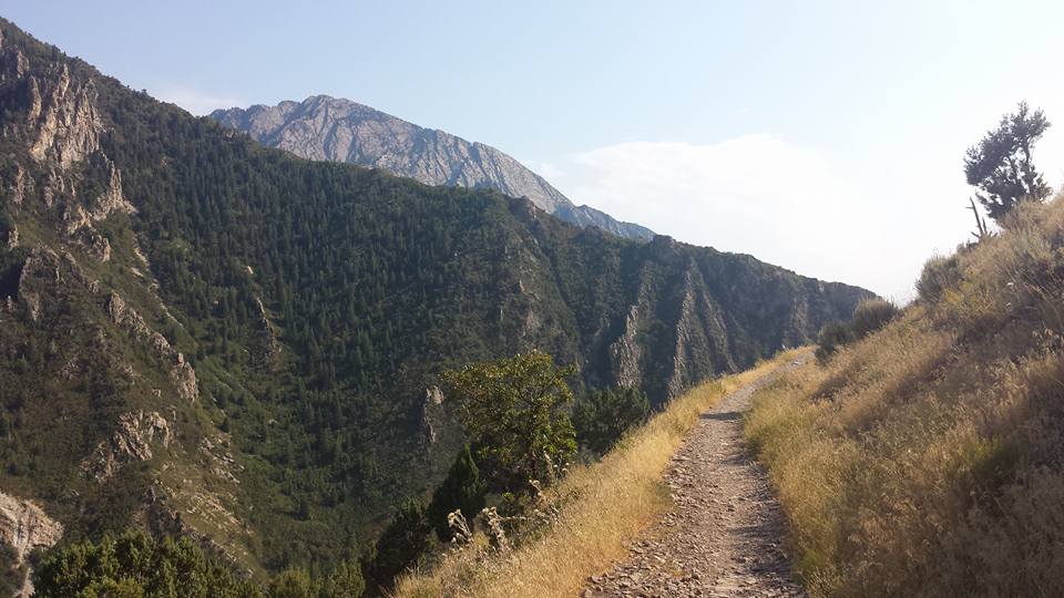
The second half makes that ascent so worth it. The trail rides fairly flat along the ridgeline, providing views down into the canyon and also of Salt Lake Valley. Especially during Autumn, you’ll see vibrant fall colors lighting up the canyon!
Once you reach the “tip” of the ridge, you’ll see a Y-shaped piece of pipe and you’ll know you’ve reached the summit. With over 180 degree views of the Salt Lake Valley, I recommend going at sunset and taking a minute to soak it all up.
I feel like I’m back in the woods of New Hampshire on this hike– thick forest surrounding the trail, offering ample shade. Lots of switchbacks provide a great workout and an even better view at the top.
Drive 3.4 miles up Millcreek Canyon and the parking lot for the trailhead will be on your right, immediately after passing Millcreek Inn. This is also where the South Box Elder Picnic Area is located. If you’re facing the restrooms, the trailhead is to the right of them.
This hike climbs 1,279 feet in elevation, so you definitely earn your views. Be sure to stay right at the beginning of the hike as you approach a fork in the trail–there’s a sign that will say “Desolation Trail” and follow that arrow. The hike starts fairly steep but the shade provided by the trees certainly makes it a more pleasant climb up.
About halfway up the trail, you’ll come up on another fork in the trail. Stay right once again (that will lead you up a little boulder). I’ve missed this turn twice before, lost in conversation and not looking up! So keep your eyes peeled.
About three-quarters of the way up, you start to break treeline and get full views of the surrounding canyon. The switchbacks keep things interesting by dipping you back into the shaded woods, then out on to the ridgeline. The trail flattens out a bit after the first half of the hike. The trail can be narrow in areas so use careful footing and be wary of hikers coming from the other direction.
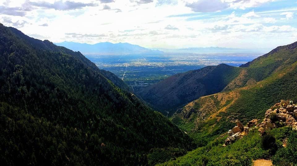
When reaching the top, you’ll get views looking down into Millcreek Canyon and of the whole Salt Lake Valley. Climb up on some boulders to catch even better views (and snag some cool pictures).
Appropriately named, this lake is a great place for dogs to splash around in the water after a hot hike. But I actually recommend this hike in the wintertime. While you won’t get expansive views like Rattlesnake Gulch or Salt Lake Overlook, there’s something serene about seeing Dog Lake covered in pristine, untouched snow. But check avalanche conditions first because this trail goes through potential avalanche terrain.
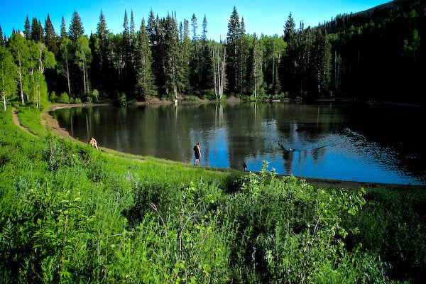
The Big Water Trailhead is all the way up Millcreek Canyon at the end of the road, about nine miles. There’s a sign for the trailhead in the southeast side of the parking lot–you’ll know you’re on the right trail if you immediately cross a small bridge.
You’ll climb 1,279 feet in elevation over the course of 2.6 miles, which makes it quite manageable. You’ll cross the first small bridge at the beginning of the trail and soon come to a fork in the trail. Stay straight and follow signs for Upper Big Water and Dog Lake.
From there, simply enjoy the trail and surrounding big, tall trees. The trail yo-yos between being really wide and narrow, though never too big of a concern. Walk around the whole perimeter of the “lake” (more like a big pond!) when you reach the top.
*************
I hope you enjoy these hikes as much as I have! If you’re looking to take on a more strenuous hike with epic views, check out my Mt. Timpanogos Hiking Guide or Mt. Nebo Hiking Guide.
